Egypt VS Ethiopia
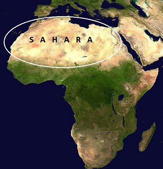
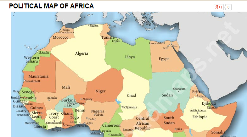
Since the ancient times, the Egyptians had the fortune to be protected by their deserts, and they had the misfortune to leave in their deserts, because Egypt is located in Sahara, the largest desert of the earth. See maps 1 and 2.
Picture 1

http://www.ubunturoom.com/wp-content/uploads/2014/11/africasatview.jpg
Picture 2

https://thehowserhouse.files.wordpress.com/2013/04/africa-political-map.gif
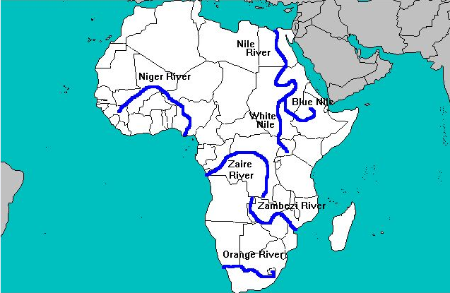
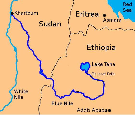
The life of the Egyptians, their history and civilization, lies within a few miles from the river Nile, and it is said that if the Nile was to stop sending its waters to Egypt, everyone would have to leave the country. The Nile is considered to be the longest river in the world, it discharge in the Mediterranean Sea, and it has two major tributaries, the White Nile and the Blue Nile. The White and the Blue Nile unite at Khartum, which is Sudan’s capital. See maps 3 and 4.
Picture 3

http://www.josephhilton.com/blog/1/physical-map-of-africa-rivers-and-mountains-i12.gif
Picture 4

https://upload.wikimedia.org/wikipedia/commons/2/24/Blue_nile_map.png
Due to Egypt’s dependence on the Nile, the British had asked all the countries crossed by this river to sign an agreement, which gave Egypt the right to veto the construction of any projects over the Nile i.e. dams etc. The agreement also allocated Egypt 48 of the 84 billion cubic meters of Niles waters each year. See the article of the center left American think tank, Brookings Institute, titled “The limits of the new “Nile Agreement””, April 2015.
As expected, the other countries crossed by the Nile are not very happy and they question Egypt’s privileges over the Nile. In recent years there was a high possibility of a military conflict between Egypt and Ethiopia, because Ethiopia and China want to construct a huge dam in the Nile, in order to produce huge amounts of hydroelectric power. Ethiopia would use this energy for herself, but also export it to her neighbors. As you can read at the following BBC article, titled “Egypt, Ethiopia and Sudan sign deal to end Nile dispute”, March 2015, Egypt, Sudan and Ethiopia signed an agreement about the construction of the dam. I do not know details about the agreement, but I guess Ethiopia agreed to provide Egypt and Sudan with some of the electricity that will be produced by the Blue Nile.
However the issue is far from over, because as you can read at the Brookings article the three countries have not agreed on the critical issue of how they will share Nile’s waters. With so many countries claiming Nile’s waters, it is sure that the Nile will continue to be a geopolitical hotspot.
For the Brookings article see
“The limits of the new “Nile Agreement””, April 2015
3rd Paragraph
These disagreements over the use of the Nile are not recent and, in fact, have a long history because of these countries’ high dependence on the waters of the Nile. In 1929, an agreement was concluded between Egypt and Great Britain regarding the utilization of the waters of the Nile River—Britain was supposedly representing its colonies in the Nile River Basin. [1] The Anglo-Egyptian Treaty covered many issues related to the Nile River and its tributaries. Of particular relevance to the present discussion is that it granted Egypt an annual water allocation of 48 billion cubic meters and Sudan 4 billion cubic meters out of an estimated average annual yield of 84 billion cubic meters. In addition, the 1929 agreement granted Egypt veto power over construction projects on the Nile River or any of its tributaries in an effort to minimize any interference with the flow of water into the Nile.
http://www.brookings.edu/blogs/africa-in-focus/posts/2015/04/28-new-nile-agreement-kimenyi
For the BBC article see
“Egypt, Ethiopia and Sudan sign deal to end Nile dispute”, March 2015
http://www.bbc.com/news/world-africa-32016763


