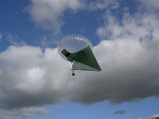
Understanding the resources helps in efficient decision making. In this context for spatial knowledge images can be used - such as google maps. Drones could be used for taking higher resolution images. Drones fitted with cameras enable one to access spatial and temporal information for monitoring and management of crops and water usage. SimilarlyBalloon kites (Kytoon / Helikite) fitted with 360 degrees cameras (HD and IP cameras also infrared cameras) Solar powered - could be used for capturing any area images and anytime. They are ideal for continuous monitoring of the resources. At least 4 or 5 such balloon kites could be deployed in a village to cover an extent about 500 to 1000 acres.
Idea
The local school children and their teachers could be involved in this initiative. A few interested teachers and children would be trained. They would fly the drones in their respective villages in the designated paths. They could also manage the information from the balloon cameras. Provide decision support services to the farmers on demand. In turn for children it is a great learning experience and also support the local farmers. Some of the activities they could do are: