FUERTEVENTURA, LANZAROTE AND HIERRO
THE three islands of Fuerteventura, Lanzarote, and Hierro, complete the group of seven Fortunate Isles, as the little satellites of Graciosa, Alegranza, Montaña Clara, are hardly more than large rocks, uninhabited and only visited occasionally by fishermen.
Fuerteventura, though by no means a very small island, being over 60 miles long and about 18 miles broad, has remained in a primitive and unexploited condition, because in spite of the fertility of the soil, which is said to be remarkable, the scarcity of water is great and the inhabitants are entirely dependent on the rainfall. In a good year, namely a rainy year, the island grows a very good wheat crop, almost larger than that of any other island, but the absence of fresh-water springs, or the apathy of the natives in not making use of what there are, has prevented any agricultural development. The island has no pine forest and trees are scarce: great parts of it are barren, sandy and rocky plains, and the little vegetation there is, is said to resemble that which is found in certain parts of the northern deserts of Africa. Its highest point is only about 2700 ft. and is called Orejas de Asno (Ass’s Ears), situated in the sandy peninsula at the extreme south of the island. At the present time travellers are warned that drinking water is scarce, nasty, and frequently has to be paid for. Whether the island is even drier than it was at the beginning of last century I know not, but Berthelot and his companion remark that there were many good springs, which even in July, the driest month, were cool and clear, but were allowed to waste themselves, no trouble being taken to collect the water either for irrigation or domestic use.
Both Fuerteventura and the neighbouring island of Lanzarote are given a distinctly African appearance by the extensive use of camels as beasts of locomotion and burden, donkeys even being comparatively uncommon and difficult to procure so communication between the villages is almost entirely carried on by means of camels.
Lanzarote received its name from a corruption of the Christian name of a Genoese, Captain Lancelot de Malvoisel, and in the old Medici map the island is marked with the Genoese coat-of-arms to show that it belonged to that town.
Though not as near the African coast as Fuerteventura, which is only about 60 miles from Cape Juby, the island is very African in aspect in places, the camels, the vast stretches of blown sand and the absence of vegetation being suggestive of the Sahara.
The few springs in the north of the island are utilised for growing crops of wheat and tomatoes, but are not of sufficient size to allow of any extensive plan of irrigation, and in the south the inhabitants depend entirely on rain water.
Lanzarote is almost the most volcanic of all the islands, and between 1730 and 1737 no fewer than twenty-five new craters opened, so it is not to be wondered at that the inhabitants were much alarmed when fresh disturbances were felt in the summer of 1824. In a series of letters written by Don Augustin Cabrera, an inhabitant of the island at the time, an excellent account is given of the eruptions. A slight earthquake preceded the sudden appearance of a new crater in the early morning of July 1, 1824, in the neighbourhood of Tao, in the centre of a plain. The crater, which at first had the appearance of a great crevasse, emitted showers of sand and red hot stones, and did great damage to the surrounding country, destroying some most valuable reservoirs, and it was even feared that Tiagua, though a long distance away, would be destroyed, as a montañeta in the district began to smoke. On September 16, the writer says that after eighteen hours the crater had ceased its shower of hot ashes, but a dense column of smoke spouted forth, and the rumbling could be heard for miles round, and from the montañeta, which at first had only smoked, came a torrent of boiling water. “Yesterday,” says the writer, “after there had been comparative quiet for some time, a loud noise was heard, and the boiling water spouted forth in torrents. At times there is dense smoke, which clears away, and then comes the water again.” Writing in October he gives a most graphic and alarming account of an eruption on September 29, when the volcano burst through the lava deposit of 1730, and flaming torrents flowed down to the sea. A noise like loud thunder had continued unceasingly, and prevented the inhabitants from sleeping, even many miles away. No wonder they dreaded a repetition of the disasters of 1730-37, as in two months two new craters had opened. On October 18 another letter says: “There is no doubt a furnace is under our feet. For twelve days the volcano had appeared dead, though frequent shocks of earthquake warned us such was not the case, and true enough yesterday the volcano burst through a bed of lava in the centre of a great plain, sending up into the air a column of boiling water 150 ft. high.” It is also said that for several days the heat was suffocating, and sailors could scarcely see the island because of the dense mist.
The island has been a source of the deepest interest to geologists, and both M. Buch and Webb and Berthelot visited it between 1820-38, spending many weeks in the island. Few travellers seem to find their way there now, as there is no port and no mole passengers have to be carried ashore.
The little island of Graciosa, only five miles long and a mile broad, separated from Lanzarote by the narrow strait of El Rio, is a broad stretch of sand covered with shells, but the three principal cones in the island are said to be volcanic, and show the origin of the island. After autumn rains, the sand is covered with herbaceous plants, and in old days the inhabitants of the north of Lanzarote used to transport their cattle to feed there.
Montaña Clara, hardly more than a rock some 300 ft. high, lies to the north of Graciosa, and Allegranza, the “Joy” of Bethencourt, as it was the first soil on which he set foot, is to the north again, and is really the first island of the Canary Archipelago, so it consequently boasts of a lighthouse. The possession of the island in old days was a matter of much dispute, as the feathers of a bird (Larus Marinus) were very valuable, and nearly as profitable as the down of the eider; also puffins, which existed here in vast numbers, were salted and sold, and now a small amount of fish-curing is done on the island at certain seasons. The greater part of the island is taken up by a crater of considerable extent, so even this tiny island is not without its Gran Caldera.
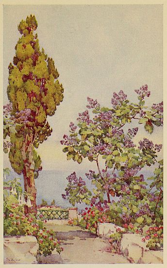
A SPANISH GARDEN
Hierro, the Isle of Iron, is to the extreme south-west of the Canary Archipelago, and for several centuries was probably regarded by ancient navigators as the most western point in the world—beyond lay the unknown. The name is a corruption by the Spaniards of the word heres, which in the language of the original Ben-bachirs, whose name was in its turn changed to Bembachos, meant a small reservoir or tank for collecting rain water. As the island is almost entirely dependent on the rainfall these tanks were of the greatest value to the natives, and in old records it is stated that a here was much more valued in a marriage settlement than land. The theory that the island was called hierro, meaning iron, because of the presence of the metal in the island is not much regarded, as we are especially told by old historians that when Bethencourt attacked the island the natives were armed with lances which had not iron heads, and the historian adds, the only iron these natives knew was from the chains of their oppressors, who appear to have treated them with great cruelty.
The excessive moisture of the air and the presence of a fair amount of wooded country which attracts the moisture, enables the flocks of sheep to live on the natural vegetation. The only water they get is from eating leaves of plants when saturated with dew, their principal fodder being the leaves and even roots of asphodel, also mulberry and fig leaves. Hierro is especially celebrated for its figs, which are the best grown in any of the islands, and extremely free fruiting. One tree alone may bear 400 lb. of fruit.
The best-known springs are those of Los Llanillos, which furnishes the best drinking water in the islands, being said to be always clear and cold, and the spring of Sabinosa. The latter is warm, smells of sulphur, and has a bitter taste and medicinal properties. One of Bethencourt’s chaplains mentions that it has a great merit: “When you have eaten till you can eat no more, you then drink a glass of this water, and after an hour all the meat is digested, and you feel just as hungry as you did before you began, and can begin all over again!”
There is no sea-port village, the landing-place consisting merely of a small cove sheltered by masses of fallen rock, and the little capital of Valverde lies two hours distant on foot. As practically no accommodation is to be relied on, those who are bent on exploring the island are recommended to provide themselves with a tent. The vegetation is said to be of great interest to botanists, and they appear to be the only travellers who ever visit the island.