LONDON THE FIRST CROSSING OF THE THAMES
It is a commonplace which must be repeated whenever the connection of the Thames with London is referred to, that the capital matter in that connection is London’s position as the lowest crossing point upon the Thames. That affirmation, standing alone, is of no use to history unless one also explains why it was so important to find a crossing place as low as possible down the river, and the many causes which combine to make that lowest crossing place the neighbourhood of London Bridge. These last especially require a full explanation because, of the many converging reasons for selecting that site, the chief were, until quite recently, imperfectly studied.
Why was it of such great importance for man, from the beginnings of a settled occupation in this island, to discover a convenient crossing place as low down as possible upon the course of the Thames? And why, when once this crossing place had been established, would it become the principal meeting-place in the country?
The answer to these questions is to be found, not only in the shape of the island, but in the position of its best soil and in its relation to the Continent.
HOUSES OF PARLIAMENT FROM VAUXHALL
It is obvious that the main connection between Great Britain and the Continent must be by the Straits of Dover. It is not only the shortness of the trajectory from the mainland to the island which makes the Straits of Dover the necessary and permanent entry into this country, it is a number of other things as well: as, that communication is very easy from the opposing shore inland; that that opposing shore was provided for ages with a harbour peculiarly suitable to early traffic—the Portus Itius (now the silted-up plain between the hills behind Boulogne); the conformation of the high land upon either side at Grinez and at Dover Cliffs which, in the centuries when the thing was important, gave an uninterrupted sight of land during the crossing; and the choice of entry which the various inlets (now filled up) afford from the Portus Lemanis behind Folkstone, the old inlet at Dover, and the old Mouth of the Stour to what was once the sheltered channel between Thanet and the mainland behind the island of Richborough. So powerful has been the topographical effect of the Straits that no revolution in travel has dispossessed them of their original importance. The great expansion in our means of communication has only emphasised the bond which is established by the Straits between this island and the Continent of Europe, and so throughout the whole of the old world. When, a few years hence, a man sets out to travel by land to India or to China, he will cross from Dover and will take his train at Calais. Were communication inland as uninterrupted throughout this island as it is throughout the opposing portion of the Continent, a system of roads would naturally have established itself, radiating from some depôt common to the various ports of Kent, just as a system of roads grew up upon the Continent, radiating from Calais and from Boulogne, and forming a network inland with such central points as Bavai, Amiens, Cassel, etc., to form pivots for the whole.
But communication within the island of Britain was not thus uninterrupted in all directions. One great obstacle lay across it from east to west, and that obstacle was the Thames. How complete an interruption the Thames formed, especially in its lower course, I will describe in a moment; it must suffice to notice here that for one who would reach all the fertile land of East Anglia and of what is now Hertfordshire, for one who would reach from the landing-place in Kent the wheat lands of what is now Essex, and the centres of population in what is now Norfolk (both of them originally capital sites of population before the growth of modern industry), the profound wedge driven into the land by the estuary of the Thames and its continuation in the tidal river formed an almost insurmountable obstacle. There was no straight line from say Canterbury to the Midlands and to the central east of the island with its great mass of arable soil. More than this: if one looks at a map of England on which moorland and waste country is distinguished from the arable soil, it will be apparent that north of the Wash the latter takes the form of a long and somewhat narrow strip corresponding at first to the lower valley of the Trent and farther north again to the Vale of York. A direct line to this arable northern strip from any principal Kentish centre (and Canterbury was such) would take one across the Thames estuary and was therefore impossible. The farther up river a practicable crossing was found the longer the detour it involved. The only considerable population in Britain that was early accessible to a road-system proceeding directly from Kent was the population of what later came to be called Wessex, that is, the central southern districts of which Winchester was the capital. As a matter of fact we find a road of immemorial antiquity proceeding directly east and west from Canterbury to Winchester along the ridge of the Chalk, but a similar road northward was blocked by the obstacle of the Thames. We shall see in a moment that the discovery of a good crossing place fairly low down in the course of the river not only saved a long detour by the upper valley for travel proceeding from the Straits of Dover to the eastern Midlands, and ultimately to the plain of York, but also afforded a fairly direct line in another direction which was essential to travel, namely, the direction of the north-west and the main ports which establish communication with Ireland.
We may take it, then, as established, that there existed from the earliest times a necessity, or a necessary tendency, to found and keep up a permanent crossing place at the lowest practicable point in the Thames valley.
Once that crossing was founded and continuously maintained it was equally necessary that it should grow into the chief meeting place of the island; that is, the chief market and therefore the chief town. Indeed the various advantages such a crossing would have form so rare a combination that we should be perfectly justified, even if we had not the evidence we have, in making certain of the existence of a great and important London early in history.
All the causes which we have seen to feed the commercial growth of the site from the sea were reinforced by the inland communications which met at this crossing place. The bridge (as I have shown elsewhere) made a terminal not only to sea-borne traffic, but to all the inland traffic from down the upper valley. It became the place of transhipment. It was further the terminal, and the necessary terminal, of the three great roads from north-west, from the north, and from the east, which combined at this point to seek the Straits of Dover to the south; and once this nexus was woven, once the market and place of meeting was fixed, it must further become the goal of other roads against which the Thames did not originally provide an obstacle. Thus it was that a road would necessarily be established from this crossing place to the west and to the south-west. Though the main traffic from the fertile Lower Severn valley would more naturally make for the Straits by way of the Chalk ridges, yet, when once London with its market supplies and depôts was established, a main road would necessarily aim at the Straits through London rather than south of the Thames. And though the secondary entries into the island from the Continent by Southampton Water, and by the ports to the west of it, would naturally send out arteries of communication northward and westward, yet their communication north-eastward through London would soon acquire the chief place. That London would have become what it did through no more than these domestic causes may well be denied. The main factor in its growth was throughout the centuries what it remains to-day—the commerce of the tidal Thames. But standing at the head of that commerce London also gathered to itself, as the main crossing point of the Thames, the communications of the whole island.
The peculiar and determining effect this had upon the military history of England I have mentioned in another study,[1] and shall expand in this. Parallel effects could be found in every other department of activity, not only in commerce but in the political machinery of England, of English feudalism, and of the English monarchy, and later of English aristocratic government. London once so formed upon its river was the centre or support of each in turn supreme in the island.
Having established this, let us consider why the crossing place came just here upon the line of the river, and to solve that problem we must recollect what it is that acts as a barrier to communication, especially in early times. This barrier is certainly not to be found in hills of such a gentle sort as diversify south England. The breadth of a stream, up to half a mile or so, and apart from broken water, though of considerable importance in the problem, is again not the chief difficulty, for man has always been able to cross water if his approach to it was unimpeded. The true obstacle was marsh—bad going. It is still the chief impediment to modern engineering, and the difficulty which men found during earlier centuries in negotiating any considerable breadth of marsh translates itself to-day into the expense which a similar undertaking now involves. Belts of marsh impeding or actually forbidding travel across them have been formed upon one, the other, or both banks in so unbroken a chain down the Lower Thames valley as to make that valley the obstacle it was and is to transverse travel. The first factor in the formation of such marsh is the tide. If you have a considerable difference between high and low water, and if that difference is further complicated by great variations between the neap and the spring tides, the difficulty of the barrier of marsh affected by such a tide will be correspondingly increased.
This consideration is often missed, and it will therefore be worth while to explain it. A fairly regular height of tide covering daily the same expanse lends itself to the establishment of a regular crossing place, and though that crossing place may not be in continuous use from the difficulty of using it at low tide, it can be regularly counted upon to serve twice in the twenty-four hours. But if there is any very considerable difference in the state of the tides throughout each fortnight, then the opportunities for using the crossing are very much reduced, unless, indeed, one has a steep shore to deal with. Under such conditions one might find a spot where crossing was easy enough at the springs, and yet impossible at the neaps; and instead of a ferry regularly in use twice in the twenty-four hours, you would have one which could only be depended upon a few times in a month.
Now the Thames is a river in which this difference is considerable, and it has greatly strengthened the power of the waterway to act as an obstacle to travel from north to south.
This, then, is the first of the factors which have combined to make the Lower Thames the obstacle it was and is to travel. If we compare the Thames in this respect with the other great rivers which we have seen to be its parallels upon the Continent, we shall be struck by the greater effect of the tide in its waters.
The second factor in the establishment of such an obstacle is the type of soil over which the water works. It is evident that a tidal river and estuary in which sand and gravel or even chalk form the riparian soils will less produce marsh than clays will. A river which washes the silt of clays up and down with its tides will be defended by worse belts of bad land than one which runs through the other types of rock. Now in this respect also the Thames has a bad pre-eminence over its rivals. Chalk only comes near the stream once or twice, and for a very short distance, in its lower course, and though gravel and sand, as we shall see, approach the banks in more than one place (and ultimately determine the site of London), this kind of soil is nowhere that which the mass of the stream churns up or carries down in its course. The Thames deals for many miles of its upper tidal waters with clays, bringing them down towards the mouth, and has settled them for centuries upon either side of its channel in the shape of deep alluvial marshes.
But there is more than this.
The third factor in the problem depends upon the contours of the land upon either side of the river. A river with steep banks, fairly narrow, bounded by hills, even though it be a highly varying tidal stream, and even though it scour through a great part of its tidal course a soil of clays, cannot form wide belts of marsh upon either bank.
It so happens that the Lower Thames—until the site of London is reached—nowhere enjoys even a short stretch of steep-on shore upon both banks at once. The few spots where higher land comes down to the water’s edge upon the southern or right bank are faced in every case by great level stretches opposite which, until modern works were undertaken, were regularly flooded with every return of the tide and were impassable; while the lower and smaller patches of land on the north bank (as at Purfleet or Grays) have marsh opposite them also to the south.
In this respect the Scheldt appears under primitive conditions even worse off than the Thames; but the Seine continually enjoys steep banks after the first twenty miles or so up from its estuary, and in at least half a dozen places from Caudebec (which roughly corresponds to Gravesend) and Rouen, the first bridge (which we have seen to correspond to London), there are opportunities for crossing the tidal Seine, even under primitive conditions, with no considerable obstacle of marsh upon either bank.
Now if we combine all this and consider the total effect of all three factors in the Lower Thames valley we shall understand why no great road ever attempted to cross it, and why no line of travel runs transverse to it to-day. A mere examination of the contours would be almost sufficient, presenting, as they do, great flats in most places, stretching for miles from the main stream of the river. But beyond this you have the great variation of the tide and the type of surface soil with which the stream deals.
Civilisation has so considerably changed the aspect of all our streams, it has so embanked them and drained their neighbourhood, that in order to appreciate the original conditions which made it impossible to find a crossing place below London one must consult the new sheets of the Ordnance Geological Survey. They give us the drift or top-soil—which alone of course concerns travel. In this new survey the area covered by alluvium and the line where that alluvium impinges upon the older and harder soils to the north and the south are very clearly marked. That area with its boundary line gives one the original area and the original boundary line of the Thames’ marshes, and it is very instructive.
The problem is one of approach from the south. From the north there is no firm soil at all within the neighbourhood of the riverbed from the sea upwards until one reaches the slight eminence of the City, unless one counts the isolated patches at Purfleet and Grays, the approach to which from the north was not only originally difficult but connected with no reasonable line of travel. One has but to look at the map to see that Purfleet could have been approached from the north by no considerable road. It might have formed some sort of terminal for an eastern road but only that at the expense of a long detour such as is made by the main road to-day through Ockendon or by the railway, for immediately behind lies a belt of what was originally marsh. Moreover, even if primitive travel had drifted by this somewhat circuitous route to the hard patch at Purfleet, it would have found no crossing there; immediately opposite lay the very wide belt of marshy land which flanks either side of the Darent. That river comes in almost exactly opposite the small belt of natural hard on which Purfleet stands.
Primitive travel, then (and for that matter modern travel too, unless it is at a great expense of engineering), could not approach the northern bank of the Thames between the sea reaches and the City of London save, and that with difficulty, by the very small exceptional patches of Purfleet and Grays, and at Purfleet would have discovered no opportunities for a crossing: the bank opposite being a particularly wide and impossible stretch of marsh at this point.
Now as to Grays: That very pleasant place does give some approach both in soil and contour to the water from the north. It is just on the edge of the chalk, just above the old limit of high water, and its original nucleus, though not actually on the stream, would require but a short causeway to reach it.
But Grays is in the same bad topographical case as Purfleet, only rather worse. It is still less of a terminal for any road from the north. It connects with the east only through Stanford and the Horndon roads. To the north of it lay, completely cutting it off from any communication, the belt of marsh of which Mordyke is now the drainage line, and of which Orsett Fenn is the principal survival.
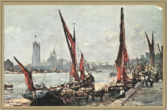
We have, then, on the north, only Purfleet and Grays; and both must be rejected. On the south, however, there is a series of isolated natural wharves which approach the main tidal stream, and not only stand fairly steep-on to its rise and fall, but are further of a soil upon their surface which permitted travel and an easy approach to the river in early times. These are, counting from the sea-reaches upward: Gravesend, where the chalk comes right down to the Thames; Greenhithe, where a tongue of the chalk juts out and touches the water; Erith, the point where the gravels, which some mighty stream laid down when the rivers of Northern Europe were discharging ten, twenty, or a hundred times the flood they have to-day, first approach the existing stream. At Woolwich sand and gravel closely approach the river and line it for so considerable a distance as to afford the platform for a fairly large town. Next up-river the same formation of gravels gives at Greenwich a hard along the stream, and immediately above another spit of the same actually touches the river at the point where used to stand the isolated village of Deptford.
Now any one of these natural hards along the south bank of the Thames between London and the sea would have afforded an excellent platform for the crossing of the river. It is true that the Thames is somewhat wider in its lower reaches than at the pool, but the difference was not so considerable as to balk those who first instituted the ferry and later the bridge of London. If one could cross the half-mile of water which lay before one at extreme high tides under the earliest conditions at Southwark, or bridge (as was done so long ago) the four hundred yards of the mainstream, there would have been no difficulty in dealing with the quarter of a mile at Deptford or at Greenhithe, nor even with the rather broader stream opposite Woolwich.
Save perhaps by a bridge of boats, a permanent crossing could not have been attempted at Erith or at Greenhithe, though the narrowing of the stream at Gravesend might well have allowed a more stable structure to be established. At any rate, a crossing even so broad as that opposite Erith has nowhere in Europe interfered with the passage of commerce, or of arms where both sides of a great stream lent themselves to such a passage. But it is here that each one of the points I have mentioned is at fault. Opposite Gravesend as opposite Greenhithe, opposite Erith as opposite Woolwich, Greenwich, and Deptford, there lies upon the northern bank a belt of marsh which forbids traffic. Tilbury Fort, opposite Gravesend, stands upon a tiny circle of harder land, but all around it are the Chadwell and the Tilbury marshes. Greenhithe has right against it the projecting expanse of West Thurrock Marsh, Erith the whole breadth of Wellington and Rainham marshes; and, as one approaches London, and the river narrows, matters seem only to get worse. Woolwich faces the expanse of originally flooded soil between the Lea and the Roding, with the most of which even the economic forces making for the expansion of London have been able to do nothing, and of which so unpleasant a relic of its original condition is left in Plaistow Marshes to-day; while opposite Greenwich and Deptford lay that perfectly impossible morass, which, though turned into water meadows by a river wall many centuries ago, is still perhaps the worst building ground within the London area. We call it the Isle of Dogs.
The reader must not imagine this lack of any two opposing hards upon London River below the City to be due to some coincidence. It has a fairly obvious geographical cause. Those points where the gravels and the chalk were touched by the scouring of the stream were naturally the outer cusp of its curves. The river having first determined a bend to the south or to the north, would eat away more and more on the outer edge of those bends (which the stream always follows both in flood and in ebb), and scour away the bank until it struck harder soils and was there checked. Deptford and Greenwich lie on the outer edge of the first great southern bend; Woolwich on that of the second; Erith on that of the third; Greenhithe the fourth; Gravesend the fifth; while both Grays and Purfleet represent similar checks to the bends towards the north.
Now it is evident that the same process which makes a river extend its curves outward more and more by the scouring the stream along the exterior edge leaves on the inside of the curve an increasing tongue or wedge of alluvial deposit. What we have, therefore, on the Lower Thames, the continual opposition of marsh to the rare hards, is only what we should expect from the geological history of the river, and the crossing place which was at last found is much more of a coincidence and accident than the absence of a crossing place below.
That crossing place was, of course, finally discovered opposite the steep gravel bank upon which the oldest part of the City of London is built.
The land has been so often turned and returned in at least twenty centuries of building that it is not easy to-day to reconstruct the original conditions of that crossing; and, unless we look at all the evidence, slight as it is, it is easy to fall into errors upon it. Thus several writers upon this subject have often spoken as though the gravel-topped knoll upon which the original London stood was the sole factor in establishing the crossing, and I have myself fallen into the error of believing that the approach from the south could only be made over a long artificial causeway.
A further consideration of the evidence, and especially of that concerning surface soils to the south of the crossing, has convinced me (subject to yet further evidence which may appear) that the opportunity for a crossing near the site of London Bridge was almost as tempting from the south side as it was from the north. It is true that no considerable rise of land is to be discovered on the Southwark side until we have gone some distance from the river, and the contour lines do not, therefore, suggest an easy crossing at this spot. But much more important than the lie of the land was the nature of the surface over which travel must proceed. The rocks across which a road is driven are not of the first importance in primitive times, though they become important, of course, when the road is expected to bear very great loads, or when it is so thoroughly metalled that the presence of good stone in its neighbourhood has to be considered. What is important to a primitive track is the immediate soil under foot, and if that be fairly hard and dry it can be quite shallow and yet sufficient for the purposes of travel.
Thus, one can point out to many a path across the clay of the weald which picks its way from one shallow patch of sand, gravel, or stone to another, over country the main base of which is clay, and there is a similar example (with which I have dealt in another volume)[2] in the upper valley of the river Wey. There, once the primitive track has left the chalk and come to the marshy alluvials of the lower levels, it picks its way in this fashion from one long strip of gravel to another; and though these strips of gravel are shallow—mere casual drifts in many cases—they are sufficient for the purposes of the road. Now in the case of the crossing of the Thames at London, the new Geological Ordnance Survey, as it gives the drift as well as the rocks, shows us that a spit of sandy gravel projected into the alluvial mud of the Thames valley just opposite the “bluff” upon which the oldest part of London stands, and indeed projected so far towards the stream that the last traces of it are not lost until beyond Guy’s Hospital—that is, until within little more than a furlong of the present high-water mark. The causeway which might therefore be necessary to approach the stream from the south in all states of the tide need only have been such a hardening of the track over the mud as is necessary between the high- and low-water mark of any tidal river where a ferry is to be established, and we must believe that the river at high water washed the gravel spit.
Upon the farther or northern bank traces of artificial embankment (indicating the original limit of alluvial mud upon that side) have been found upon the line of Thames Street, and the Roman wall ran just to the north of it. The total width, then, which had to be negotiated at this point was one at the very most of seven hundred yards, and perhaps much less than that, and it was one which at high water was flanked to the south, as to the north, by a hard surface across which the river could be approached.
No such conditions were to be discovered between this point and the sea, and, far inland as this point was, it was therefore the lowest practicable crossing of the Thames. Thus it was that the Thames established London.
It has also been maintained that this crossing formed not only the first practicable way to one coming up from the sea and seeking the lowest passage of the Thames,but also that no practicable passage could be found for some considerable way up the river either; in other words, that the opportunity for going over the Thames near the site of London Bridge was an isolated and all the more valuable one from the absence of similar opportunities above as well as below it.
We must be very careful before we accept such an argument. It is as certain as inference can make it that an original crossing, perhaps older than that of London, passed the Thames in the neighbourhood of Lambeth Bridge. The road which the Romans made or straightened from the south-east, that is, the first great main road from the Straits of Dover to the north, the Watling Street, points directly to this spot, and the presence of good going on the south bank at least strengthens the conjecture, coupled as it is with the antiquity of Westminster as an inhabited site, and the long-established ferry which plied for centuries from the neighbourhood of Lambeth Palace to the opposing “Horseferry” Road.
The formation of the surface-soil in this neighbourhood is well worthy of study.
Immediately in the bounds of Lambeth Church and Palace the superficial hard gravels (which have been approaching the river for two miles and leaving a belt of marsh to their right or north) touch the stream. Not quite opposite, but nearly so—quite nearly enough for the establishment of a ferry—the large isolated patch of gravel which lay between the two mouths of the old brooks and which supported the nucleus of Westminster affords a good landing-place. It is true that there is (or was) a patch of bad ground immediately to the north of this gravel, but very soon the rising ground which is now marked by Constitution Hill and Grosvenor Gardens gave good going and led the track up, nearly coincident with Park Lane, to “Tyburn,” whence the Watling Street makes straight for the north and west along the line of the modern Edgware Road.
For a mile or two farther up, until the gravel in Chelsea was reached, opposite the steep land of Battersea crossing may have been difficult, but between Battersea and Chelsea it was certainly as easy in early times, or easier than at London Bridge, and after that, of course, as one goes westward the passage of the river becomes easier and easier until on the present western limits of London, at Brentford, you have what is almost certainly an original ford across the river, at low tide at least, and one which some authorities have regarded as the crossing place of Julius Cæsar.
It is not, therefore, because the crossing at London is unique—it is, on the contrary, but the last of a long series of crossings—it is because it is the lowest crossing of the Thames that it came to be of such capital importance in the history of this island. Upon it converge the great military road from Chichester and the Great Port, the still more important road from the Kentish ports, and in particular from the Straits of Dover, the road from Shoreham going directly northward, of which such slight but such conclusive evidence has been discovered. These from the south—while from the north the great eastern road from Colchester and the corn-lands of Essex, the northern road with its branches to the ports and to the corn-lands of East Anglia, the north-western road from the garrison at Chester with its branch to the arable lands of Lancashire, past the fortress of Manchester, and even the western road from Bath and from the mines of the Mendip and from the garrison of Caerleon, all converge.
Once this scheme of ways had been established (and they were certainly all complete before the end of the fourth century), once London had thus become the hub of a wheel of such spokes and the centre of such a web, the Thames which had made it, making also its commerce from the sea and its value as a point of transhipment between inland and sea-borne traffic, assured its eminence over all the other towns of the island.
I will not here repeat the arguments which I have dealt with in other studies, and which are advanced in defence of various hypothetical dates for the first building of the bridge. Its establishment across the river marked, of course, the completion of the process whereby London was produced. For once the bridge was there it was a necessary terminal to sea-borne traffic, and a convenient one to inland traffic; it was the military communication between north and south, and the commercial one as well. I will close by distinguishing between the very few pieces of actual evidence and the presumption built upon them.
We have a line of Roman remains pointing to a place upon the northern bank, somewhat to the east of London Bridge and almost coincident with the opening of the subway. Opposite it we have the old landing place near “Stoney Lane” which is supposed to indicate a southern causeway meeting this identical causeway from the north. Between the two there may have been in early Roman times a ferry. On the other hand, we have the Stane Street pointing directly at the southern terminal of old London Bridge (a trifle to the east of the modern bridge) and we have the undoubted presence of that bridge through the Dark Ages, which did not, as a rule, possess any considerable monument which they had not inherited from Rome. We have, further, the fact that the earliest line traceable for the Roman town puts London Bridge nearly at its centre; and again the fact that on the line of the bridge certain Roman relics have been unearthed or fished up.
In the absence of more positive evidence we may take it as sufficient for history that in the natural course of things a ferry probably preceded the bridge, yet the bridge existed, if not when the Romans came, at any rate shortly after their occupation.[3]
Thus it was, then, that the River of London seems to have made London.
The Thames was so situated in the island that a crossing place of a permanent sort had to be established as far down the stream as possible. This place was found where the stream was still broad, tidal, and a port. Once bridged the same spot would mark the terminal of sea-borne traffic and the place of exchange between foreign and domestic produce, while the roads radiating north and south from such a crossing would further establish its pre-eminence.
But that pre-eminence was, from some very early period, commercial. The first mention of London in recorded history, the phrase of Tacitus, speaks of the town particularly as a market. As a market London has grown, and as a market it is still chiefly eminent. But London is a market only because it is a port, and it is the port of the Thames. In that aspect I will next consider the connection between the town and its river.