TEASER - 14
LAT- X
The latitude reading / value (Degrees) on the summit of a mountain, (say Everest, Chomolungma or Sagarmatha) and at its root is always same:
(a) True
(b) Falls
THE EXPLANATION:
The earth's surface is divided by an imaginary set of grid lines, the longitude and the parallels of latitude, which are referred as geographic coordinate system. These coordinates appear on all standard maps and on some they may be the only way of locating and referencing a specific point.
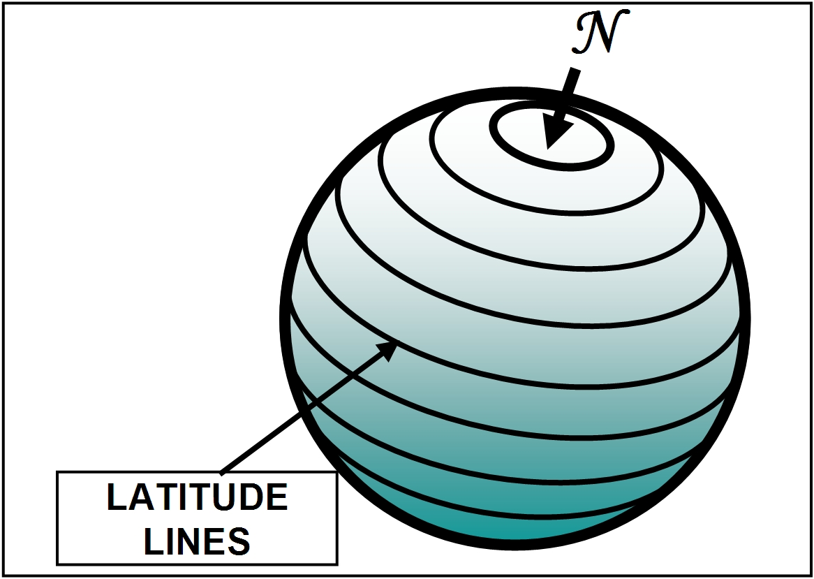
(a) Latitude lines
Latitude lines on the earth's surface are drawn connecting all points equidistant (parallel of latitude) from the equator and form a set of rings around the globe. The latitude value is measured from the equator, with positive values going north and negative values going south. The equator is 0°latitude and the North Pole and South Pole are 90°N and 90°S latitudes, respectively. The length of one degree of latitude averages about 69 mile (110 km), it increases slightly from the equator to the poles as a result of the earth's polar flattening.
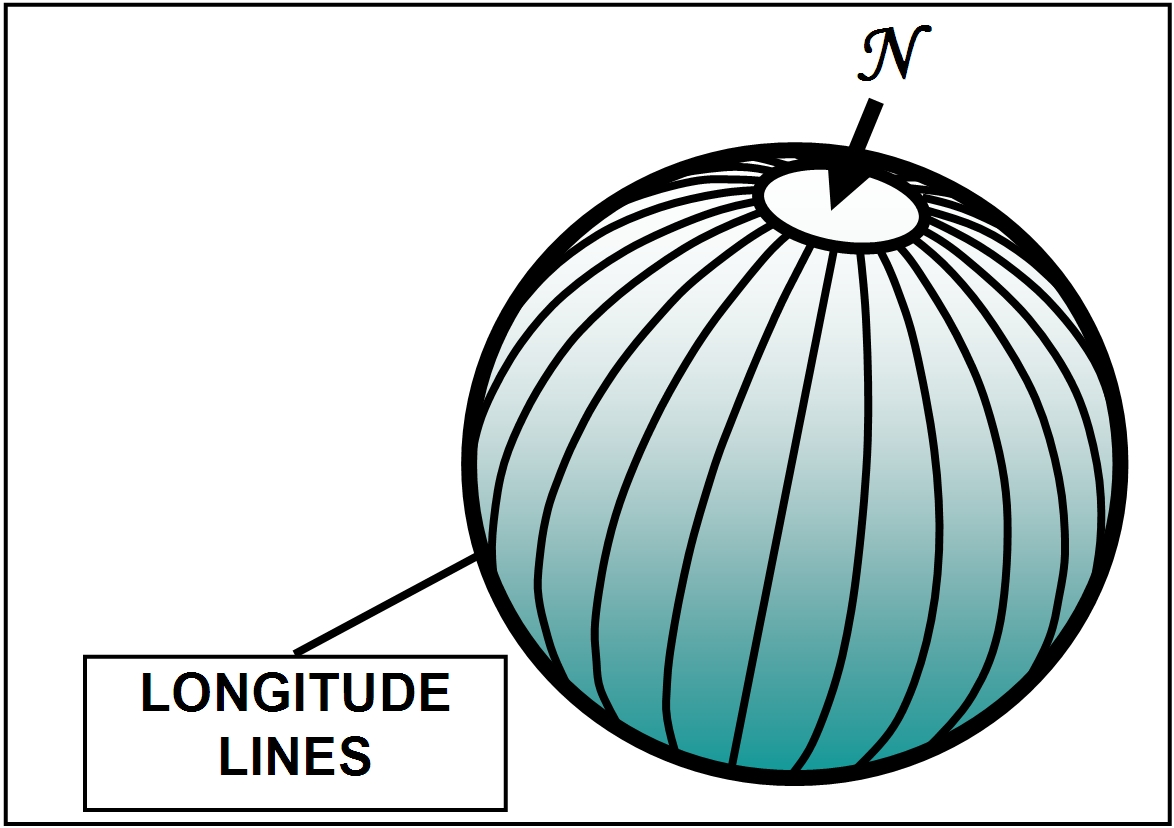
(b) Longitude lines:
Longitude lines are a set of north-south rings crossing the equator at right angle and converging at poles. These lines form great circles and always divide earth into two. By international agreement, the meridian passing through the original site of the Royal Greenwich Observatory at Greenwich, England, is designated the prime meridian, and all points along it are at 0° longitude. All other points on the earth have longitudes ranging from 0°to 180°E or from 0°to 180°W.
The Angle ‘LAT-X’
The height of an elevation or depression on earth is measured along the plumb line. A plumb line is defined, as a line from which if a weight is suspended it is directed exactly toward the earth’s center of gravity.
The longitude plane and plumb line pass through the center of earth, and fall on same plane and do not cut each other. On the other hand, barring equator, the latitude plane does not pass through earth’s center hence both plumb line and latitude line do not fall on same plane and cut each other therefore are oblique to each other. The crux of the anomaly lies in the phenomenon of obliqueness of latitude plane with respect to plumb line.
The plumb line cuts latitude at an angle which increases from zero degree at equator, to 90 degrees at poles. This angle is referred to as “LAT-X” here.
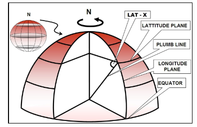
NORTHERN HEMISPHERE SHOWING ANGLE LAT-X
As we know, contour maps are generally made on a base or reference plane, so that height or depth are calculated by counting contours up or down from the reference or base plane. While making a contour map, the location of a point on earth surface, such as a mountain top, is transferred straight down onto a base plane along plumb line and not along latitude line. Except along equator, the Latitude lines and plumb lines (S - R line) are always oblique to each other, hence the location of S and R would not be at same point with respect to latitude values. However, on a contour map both S and R would be located exactly at same place, irrespective of height hence would have same latitude value.
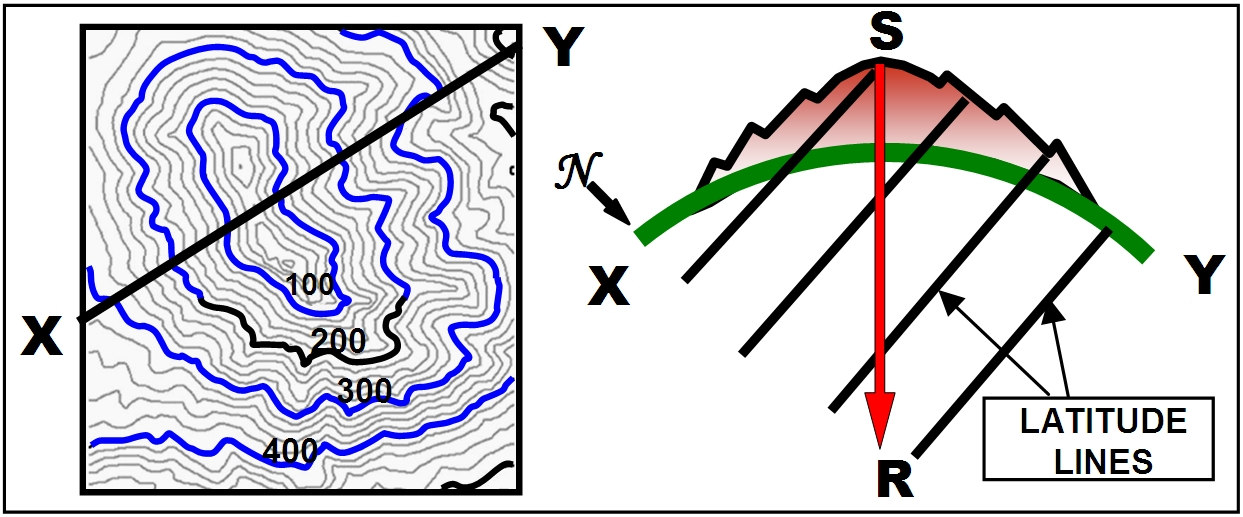
CROSS SECTION (X-Y) SHOWING S-R LINE (PLUMB LINE) OBLIQUELY CUTTING LATITUDE LINES
The summit (S) and root (R) of a mountain can be likened to two floors of a building with S being first floor and R being ground floor. The floors are linked by a stair case which is parallel to latitude plane. Walking along the staircase from ground floor to first floor is like walking along a latitude plane. The staircase is always diagonal cutting ground and 1st floors at different points. The slope of staircase would depend on angle ‘X’ and gap between two floors.
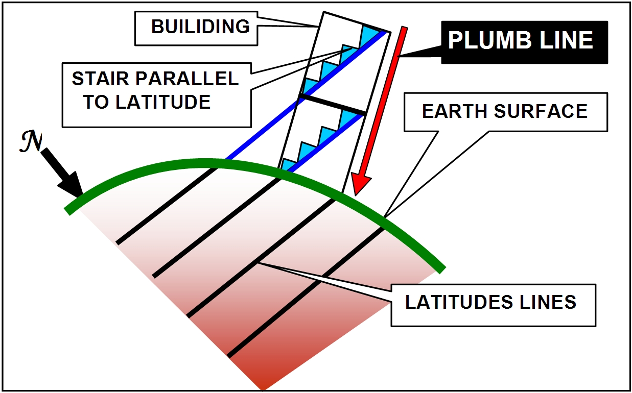
LATITUDE LINES CUTTING A BUILDING DIAGONALLY
Therefore, the summit (S), like first floor, shall not have same latitude (staircase) as that at root (R) or ground floor, contrary to a contour map where both S and R are placed at same point.
********